|
 I
began planning and physically training in the Fall of 2011. I made
the decision not to buy new equipment until after completing the
first section for two reasons - I would know if I wanted to continue
and I would learn a lot and observe from the people I met along
the way. Both my pack and sleeping bag were 30+ years old - a lot
has changed, especially in lightweight hiking gear. The ideal on
a long hike is to keep your base weight (gear minus food and water)
to 15 pounds or less. One way to compensate for the weight of my
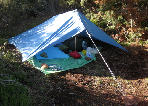
sleeping bag was to not carry a stove or a tent. For cover at night,
when needed, I would take the fly sheet on my tent (also 30+ years
old!) and use my hiking poles as tent poles. I
began planning and physically training in the Fall of 2011. I made
the decision not to buy new equipment until after completing the
first section for two reasons - I would know if I wanted to continue
and I would learn a lot and observe from the people I met along
the way. Both my pack and sleeping bag were 30+ years old - a lot
has changed, especially in lightweight hiking gear. The ideal on
a long hike is to keep your base weight (gear minus food and water)
to 15 pounds or less. One way to compensate for the weight of my
sleeping bag was to not carry a stove or a tent. For cover at night,
when needed, I would take the fly sheet on my tent (also 30+ years
old!) and use my hiking poles as tent poles.
The one question I was asked most was "Are
you taking a cell phone?" Call me old fashion but taking a
cell phone/GPS just didn't fit with my style. Besides, I knew that
there would be lots of hikers starting in early April and if I needed
a cell phone, one would come along eventually.In addition, much
of the trail is through very remote terrritory with little or no
cell phone coverage. I had good maps and knew how to read them,
a compass, and a very loud whistle if I fell off the trail.
 The
plan was to start at the Mexican Border and hike the first 210 miles,
putting me at Interstate 10 at the base of Mt. San Jacinto, approximately
20 miles north of Palm Springs. As my departure date began to draw
near, the big question began to be the condition of the trail around
Mt. San Jacinto, as a series of late storms were dropping lots of
snow. I felt that by late April the way would be clear. The
plan was to start at the Mexican Border and hike the first 210 miles,
putting me at Interstate 10 at the base of Mt. San Jacinto, approximately
20 miles north of Palm Springs. As my departure date began to draw
near, the big question began to be the condition of the trail around
Mt. San Jacinto, as a series of late storms were dropping lots of
snow. I felt that by late April the way would be clear.
On April 2nd I flew to Orange Co., spent a few
days visiting with my mom in Laguna Beach, and on April 5th took
the train to San Diego. My cousin Paul and his wife Adrienne, who
live on Coronado Island, picked me up and took me to a wonderful
Italian restaurant for my last real meal before hitting the trail.
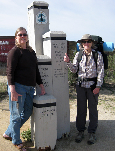
Early the next morning Adrienne (my Trail Angel!) drove me to the
trail-head at Campo. I think Adrienne was more excited than I was.
Thank you Adrienne for all your support! At 9:15 am I began the
hike. Was I really doing this?!
 I'm
not going to give you a blow-by-blow description of my hike, but
some random thoughts. My friend Larry told me I'd get blisters -
I said no, I'm walking 6-8 miles a day training and haven't gotten
any blisters - I had blisters by day 2! I spent the first week in
pain. Of the group of people I met along the way I was the oldest
female and hiking alone. I met several men 60+ but no women. At
one point I hiked 4 days with three other people - a guy 27 years
old. and two females, 30 and 23. They told me several times how
I was an inspiration to them - putting in the same miles and not
complaining. Most days I hiked 12 - 14 miles, and I'd say my pack
was 30+ lbs. And don't forget those blisters. I totally blew it
on food. Apparently, it's common not to eat much the first week
or two. I was barely eating half my rations and I was sending most
of my food back when I received my re-supplies. All the food I thought
I'd need was unappealing. Luckily I was able to get junk food every
4-5 days at small stores. I learned a lot and should do a lot better
next time. I'm
not going to give you a blow-by-blow description of my hike, but
some random thoughts. My friend Larry told me I'd get blisters -
I said no, I'm walking 6-8 miles a day training and haven't gotten
any blisters - I had blisters by day 2! I spent the first week in
pain. Of the group of people I met along the way I was the oldest
female and hiking alone. I met several men 60+ but no women. At
one point I hiked 4 days with three other people - a guy 27 years
old. and two females, 30 and 23. They told me several times how
I was an inspiration to them - putting in the same miles and not
complaining. Most days I hiked 12 - 14 miles, and I'd say my pack
was 30+ lbs. And don't forget those blisters. I totally blew it
on food. Apparently, it's common not to eat much the first week
or two. I was barely eating half my rations and I was sending most
of my food back when I received my re-supplies. All the food I thought
I'd need was unappealing. Luckily I was able to get junk food every
4-5 days at small stores. I learned a lot and should do a lot better
next time.
 Of
the 15 nights I was on the trail, I spent 5 nights totally alone,
otherwise I was camping with or close to someone else. Two storms
came through while I was on the trail. During the first one I was
on my own and knowing a storm was coming, found a spot out of the
wind, though I didn't secure my stakes as well as I should have.
By midnight I had stakes pull out, the fly sheet flapping and things
starting to get wet. At 4:00 am I starting organizing for a quick
departure as soon as it was daylight - I was huddled in the middle
of my shelter trying not to get any more wet. At daylight it started
raining harder so I decided to wait for a break, then leave. At
7:00 am. I was packing up my wet sleeping bag and fly sheet (luckily
my pack stayed dry) when it started to snow! I knew I just had to
get hiking and I'd be fine. It only snowed a few minutes but it
was a wet and very windy day. Several times I thought I'd get completely
blown over. I just kept hiking. My only concern was that I wouldn't
get a chance to dry things out before it was time to make camp.
By afternoon it was intermitent rain and sun breaks. Luckily I had
descended enough that when I made camp the sun was out and I could
dry out. I really did a good job securing my shelter that night
and stayed warm and dry despite it being windy with rain showers
all night. The next storm came in 2 days later, but I shared a room
with two other hikers at an RV Park 4 miles off the trail. Of
the 15 nights I was on the trail, I spent 5 nights totally alone,
otherwise I was camping with or close to someone else. Two storms
came through while I was on the trail. During the first one I was
on my own and knowing a storm was coming, found a spot out of the
wind, though I didn't secure my stakes as well as I should have.
By midnight I had stakes pull out, the fly sheet flapping and things
starting to get wet. At 4:00 am I starting organizing for a quick
departure as soon as it was daylight - I was huddled in the middle
of my shelter trying not to get any more wet. At daylight it started
raining harder so I decided to wait for a break, then leave. At
7:00 am. I was packing up my wet sleeping bag and fly sheet (luckily
my pack stayed dry) when it started to snow! I knew I just had to
get hiking and I'd be fine. It only snowed a few minutes but it
was a wet and very windy day. Several times I thought I'd get completely
blown over. I just kept hiking. My only concern was that I wouldn't
get a chance to dry things out before it was time to make camp.
By afternoon it was intermitent rain and sun breaks. Luckily I had
descended enough that when I made camp the sun was out and I could
dry out. I really did a good job securing my shelter that night
and stayed warm and dry despite it being windy with rain showers
all night. The next storm came in 2 days later, but I shared a room
with two other hikers at an RV Park 4 miles off the trail.
 Cell
Phones with GPS - seemed to be more the norm than not. I have the
same attitude with GPS tracking in vehicles - it's sometimes better
just to look at a map! I didn't get lost once, yet those with devices
did get lost now and then. I may not have been able to tell you
exactly where I was but I wasn't far off. Cell
Phones with GPS - seemed to be more the norm than not. I have the
same attitude with GPS tracking in vehicles - it's sometimes better
just to look at a map! I didn't get lost once, yet those with devices
did get lost now and then. I may not have been able to tell you
exactly where I was but I wasn't far off.
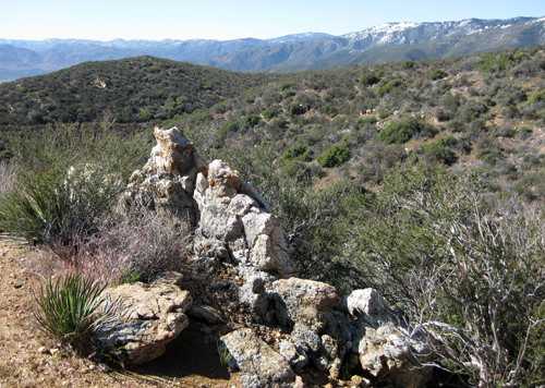
Remember those late storms. Day eleven while,
in the San Jacinto Mountains, I hit snow. Luckily I ran into a young
couple I had encountered several times the previous 2 days. They
had "yak trak" type traction aids but I had nothing -
remember, I had assumed that there wasn't going to be any snow when
I got there. Instead the trail was completely covered and we were
following the tracks of others. At one point, one of my companions
was trying to find the trail with his cell phone. I sat down, looked
at the map and realized that all we had to do was follow the base
of the ridge until we came to a stream, then head downstream to
the area where hopefully we'd find a good place to camp. I was glad
that I had fellow hikers with me as I was having a hard time making
way. At one point I had slid downhill on my back and was stuck,
like a turtle on it's back. Believe me, I didn't hesitate to play
the old lady and ask for help whenever I needed an extra hand. That
day ended with us meeting two guys from San Diego out for an adventure
weekend. They invited us to share their camp, and when I noticed
the snowshoes tied to their packs I asked nicely if I could use
a pair. Our new companions were surpised when they noticed I was
cowboy camping (not using my "tent"), but it was a nice
night and I hadn't used my shelter for a week.
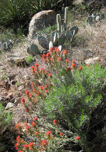
 The
hardest day was in the San Jacinto Mountains - 12 miles, very hot
day, 2,000 ft. climb, then 1,000 ft descent, and finished with a
1,000 ft. climb. Even the youngsters I encountered were dragging
their butts! The next day was the day in the snow. I was only 30
miles from my destination yet it wasn't meant to be. The trail at
miles 188 - 191 was impassable, and the reroute through Idyllwild
didn't appeal to me. And I wasn't looking forward to the last 20
miles, a 6,000 ft descent, in 100+ degree weather. Since my plan
was to end up in Palm Springs the Tram down to the valley was the
most direct option. As I headed for the Tram, I encountered 3 local
day-hikers heading in the direction of the Tram and assuring me
the trail was clear. I'll just have to do those 20 miles on another
section hike. Yes, I was definitely going to continue the PCT. The
hardest day was in the San Jacinto Mountains - 12 miles, very hot
day, 2,000 ft. climb, then 1,000 ft descent, and finished with a
1,000 ft. climb. Even the youngsters I encountered were dragging
their butts! The next day was the day in the snow. I was only 30
miles from my destination yet it wasn't meant to be. The trail at
miles 188 - 191 was impassable, and the reroute through Idyllwild
didn't appeal to me. And I wasn't looking forward to the last 20
miles, a 6,000 ft descent, in 100+ degree weather. Since my plan
was to end up in Palm Springs the Tram down to the valley was the
most direct option. As I headed for the Tram, I encountered 3 local
day-hikers heading in the direction of the Tram and assuring me
the trail was clear. I'll just have to do those 20 miles on another
section hike. Yes, I was definitely going to continue the PCT.
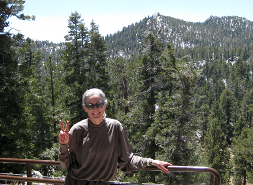
A nice couple I meet at the Tram gave me
a ride into Palm Springs and The Chase Hotel, owned by an old fishing
buddy of Mark's. It was strange not having to think about where
I would camp for the night and whether I'd have adequate water.
Two days later I was back in Seattle and thinking about what section
I'd hike next. Several people I met have trail journals posted on
the internet and I've been keeping track of their process. It's
strange to be sitting here and not on the trail making miles.
|
