 |
||||||
|
Kennedy Meadows to Tuolumne Meadows,
CA
Mile 704.7 to 942.5 |
||||||
 |
|||||||||||||||||||||||||||||||
|
The thought of doing the 240 mile Sierra Nevada section of the PCT by myself was daunting when I began to plan this section. I asked a few women I know if they would be interested in accompanying me, but there were no takers. The more I thought about it, the more I realized that by hiking in August, the busiest time in the Sierras, there would probably be more people than I would want to encounter. So in esscense I would not be alone. And as I got closer to departure the more comfortable I was going it alone.
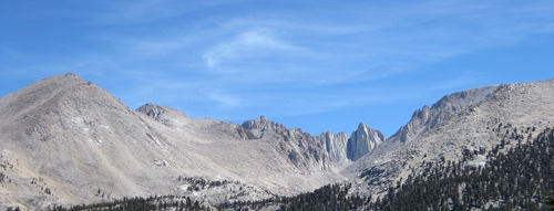
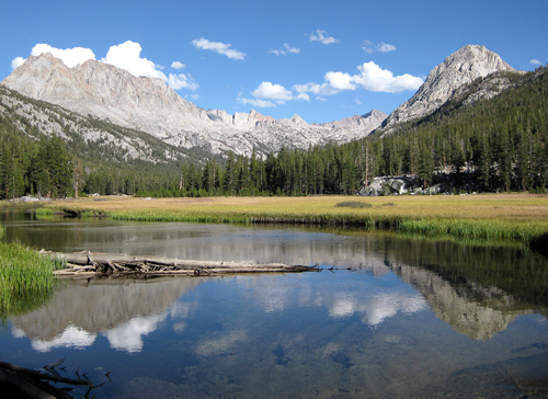
The Route: This section of the PCT would begin at Kennedy Meadows located west of Hwy 395 and NE of Lake Isabella. On the Kern Plateau, it is the entry point for the South Sierra Wilderness. I would exit the trail 240 miles north at Tuolumne Meadows, in Yosemite Park on Tioga Road after crossing ten passes over 11,000 ft. About 55 miles north of Kennedy Meadows, at the base of Mt. Whitney, the PCT and the John Muir Trail (JMT) merge and are one, until Tuolumne Meadows. The two trails do split briefly just north of the Devil's Postpile for a 15 mile section, then rejoin at 1,000 Island Lake. There were many sections of the trail where the footiing was very rocky and difficult, making for slow progress. I was getting slightly frustrated at times when I found that I could only do 10 miles or less per day. I had gotten accustomed to averaging 14 to 16 miles per day on previous sections. And when I asked another senior hiker how many miles they were doing and they'd say 12 to 15 per day my competitive nature would flare up. At one point I thought that I had miscalculated and would have to hike 14 miles a day to finish in time. But after three days of pushing myself to do 14 miles I realized that I actually had one extra day!
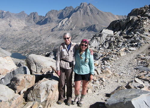
Resupplies were also going to be more difficult than previous sections. The first would be at Independence, a 15 mile roundtrip hike over Kearsage Pass at 11,712 ft. Again, my brother Dave offered to pick me up from the Onion Valley trailhead as he and his wife Cyndi liked the idea of the drive up Hwy. 395. They took me into Independence, got a motel for the night where I could take a shower, do laundry and EAT. In the morning we had a big breakfast and waited for the post office, where I sent my re-supply, to open at 9:30 AM. Once I got my box of supplies, I scrambled to re-pack as we drove back up to the trailhead. I managed to be back on the trail by 10:30 am. I wasn't looking forward to the climb back up to the pass as the day before, as I descended, it was close to 100 degrees in the valley. Fortunately, it was a little cooler and I was back on the pass by 2:30 PM.
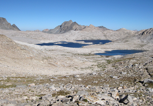
Strategy: The main concern on this portion of the trail was the elevation. Being at sea level all summer, I didn't have time to acclimatize prior to departure. This section begins at Kennedy Meadows at 6,151 ft., crosses eight passes over 11,000 ft. and is 240 miles in length, terminating at Tuolomne Meadows. We left my brother's house at 7:00 AM and I was on the trail at
1:00 PM. I hiked 6 miles on the first day, camped at 7,000 ft and
camped 1,000 ft. higher the next several nights. By the fifth night
I was camped at 10,203 ft., feeling I was now well prepared for
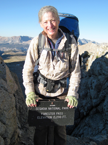
the ten passes I would be crossing, all over 11,000 ft. The other strategy I used was to camp as close to a pass as possible, then cross the pass first thing in the morning when my legs were fresh and the temperature cool. A good weather forecast allowed me to camp at 12,000 ft., just below Forester Pass, (13,153 ft), then start at 6:20 AM the next morning, reaching the pass by 7:10 AM. I try to wake up at 5:00 AM and be on the trail between 6:30 AM and 7:00 AM. The first couple of hours on the trail in the morning were my favorite, as I usually would not encounter other hikers until 9:00 AM or later. And the first hikers I would see were usually older hikers; most younger hikers don't get on the trail until after 9:00 AM.
People: The first three days and three nights of the hike I didn't encounter another hiker. I did see some recent footprints at Olancha Trail junction, otherwise I saw no one. The morning of the fourth day, while I was trying to dry out from the previous day's storm, an older gentleman, Steve, walked by, soon to be followed by his companion Mike. We had a brief conversation and figured we'd see each other later as we were camping at the same spot that night. They were both commercial pilots and doing the same PCT section. We spent the evening getting to know each other, then they were off early the next morning, with me not expecting to see them again. I would again run into them four days later while descending Forester Pass. We camped together again that night, but since I was exiting to resupply the next day, I did not encounter them again.
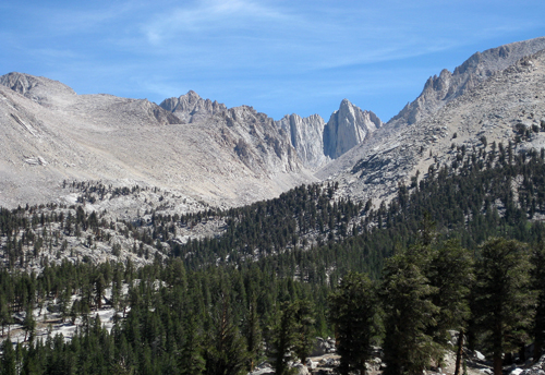
Crabtree Meadows, at the base of Mt. Whitney, is where the PCT and the John Muir Trail (JMT) merged. I would now pass approximately 40 JMT hikers a day, who were southbound out of Yosemite, while I was northbound. If I heard an accent as we greeted each other I asked their country. I began making a list. You would expect hikers from Japan, Korea, China, England, Scotland, Germany, Netherlands, Denmark, Norway and Australia. The surprises were Brazil, Argentina, Philippines, Russia, India, Czech Republic and Belarus. And I'm sure there were more countries all doing the JMT. And lots of older, single women! I met one Japanese American woman
who was 70 years old, just grooving along. I kept wondering how
she managed, being shorter then I, to navigate the many steep, high
steps over the passes. Someone commented that there were more single
women on the trail because of Cheryl Strayed's book "Wild".
Maybe. I've been encountering single women hiking for years, nothing
new, and the book hasn't been out that long. The number of single
women on the trail doesn't become apparent until one does an extended
hike. I did meet two women, who were hiking with their young children. Both were from New England. I met the first mom as I approached Forester Pass and they were descending. She was hiking the JMT with her two sons, 8 and 10 years old. The boys were doing really well. The second mom I met on top of Mather Pass, also hiking the JMT with her two daughters, 10 and 12 years old. She had already written a book about her younger daughter hiking in the White Mountains and was writing another book about this hike. When I told her about the mom with the two boys and that she was also writing a book, I could tell she was anxious to get her book out first! I only met a couple of people hiking the PCT. All of the rest were hiking the JMT. I already mentioned Steve and Mike. I met Rachel, a 22 year old recent grad from Reed College, as I was hiking back over Kearsage Pass from my re-supply. She was on her way into Independence for her re-supply, also hiking the PCT northbound. She had started her hike at Horseshoe Meadows and was getting off about 150 miles north of Tuolomne Meadows. She was with a friend who was getting off the trail, and Rachel, who would be on her own, was glad to hear that I would also be on my own ahead of her. I mentioned she'd easily catch up with me, once she got back on the trail.
I also met an older couple hiking a 4 days section with their daughter who was hiking the JMT. They had hiked the JMT 40 years ago! and in the month they spent on the trail they had met only five other hikers. Thunder storms are common in the Sierras during the month of August. Clouds start to form early in the afternoon and usually by 3:00 PM. enough moisture has accumulated aloft to create thunder showers. Lightning was a concern and I had researched what to do if caught in a serious lightning storm.
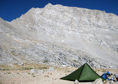
I kept my eyes on the sky all day, glad that all the dark clouds and thunder were everywhere but overhead. My luck ran out about 4:00 PM. when the sky got very dark, the lightning and thunder started (6 seconds apart!) and it began to hail. In preparation, I had stopped, wrapped my pack in a big garbage bag, and myself in a cheap plastic poncho to wait. Within 30 minutes the storm had moved over and it was raining lightly. I got back on the trail, anxious to reach a camp spot 4 miles down the trail. By the time I got my tent set up the rain had stopped but, being under trees, water dripped on the tent all night long. That was the last rain I encountered for the rest of the hike. One could not have asked for better weather. Unfortunately, hikers further north had almost 2 weeks of rain. The positive affect was that all the streams and creeks were recharged and I never had to carry more than a quart of water. I was already carrying two more pounds than usual with the required bear cannister, so less water meant less weight. This was a relief since water was an issue the first 3 days of the hike, and many sources either dried up or with a minimal flow.
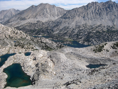
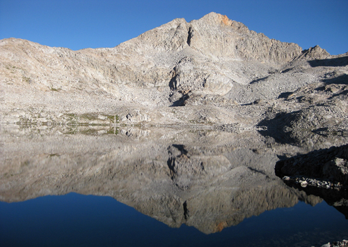
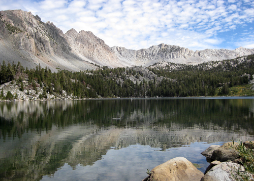
The Sierra Nevada batholith is made up of many plutons, each a
complex of igneous rocks of varying composition that were intruded
at different times. It took 130 million years to complete the creation
of the granitic rock. The rock's response to the ravages of weather,
glaciers, and streams is what has formed the grandeur of the Sierra
Nevada landscape we see today. For a more detailed explanation on the formation of the Sierra Nevada, refer to : http://geomaps.wr.usgs.gov/parks/province/pacifmt.html
|
|
Completed Sections
|
| September
2017 Mile 1498.4 - 1328.8 |
| August
2018 Mile 2393.2 - 2591.1 |
| September
2018 Mile 1153.4 - 1331.3 |