|
 The
fourth section hike was going to be a test as to how my knees were
going to hold up. In the spring, my right knee had swelled up and
was very painful after my first week on the trail. This section
was going to let me know if I could continue hiking. There would
also be several opportunities to exit the trail if problems arose. The
fourth section hike was going to be a test as to how my knees were
going to hold up. In the spring, my right knee had swelled up and
was very painful after my first week on the trail. This section
was going to let me know if I could continue hiking. There would
also be several opportunities to exit the trail if problems arose.
A summer on the boat in Alaska provided the environment
for healing. Due to terrain and the lack of opportunity to get off
the boat, I did very little serious hiking. Most of my walking was
restricted to within local villages. A friend had given me a copy
of physical therapy knee exercises which I started in mid-May and
did every other day the whole summer. By mid-August the knees were
pain free, but I was aerobically out of shape.
I flew back to Port Townsend on August 26th and
was on the trail September 2nd. My plan was to go slow and easy
the first couple of days, and give the body time to adjust to being
on the trail. I vowed that I would use my hiking poles correctly,
planting each pole with the opposite foot, every step of the trail.
On prior sections I wasn't planting my poles with each step, more
like every other step.
 This
hike would begin just south of Ashland and end at Willamette Pass
in Oregon. The logistics of getting on and off the trail once again
took some planning. The only way I can make it work is to put a
request out there and see what happens. I'm always surprised by
the generosity of others wanting to help. This
hike would begin just south of Ashland and end at Willamette Pass
in Oregon. The logistics of getting on and off the trail once again
took some planning. The only way I can make it work is to put a
request out there and see what happens. I'm always surprised by
the generosity of others wanting to help.
The first request was sent out using the PCTA
forum page requesting a ride from Medford to the trail-head south
of Ashland. Bus transportation was available to Medford, but nothing
was available to Ashland. Almost immediately I received an email
from Bill and his wife "Pinball " in Ashland offering
a ride as long as they were in town. I gave them an approximate
date and said I'd keep them posted.
Willamette Pass is only 60 miles from Eugene but
no public transportation is available. The original plan was to
leave my car at a lake resort near the Pass and hitch-hike into
Eugene. But I got an email from Cheryl and Tom, a couple we met
sailing in Mexico, who live just outside Eugene. They offered to
keep my car and pick me up when I finished. The logistics were actually
all falling together.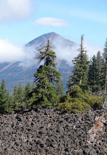
Another logistic element that I was concerned
with was an almost 30 mile stretch of trail, between
Crater Lake and Mt. Thielsen, with no water available. Since I could
not complete this stretch in less than 2 days, I decided to leave
a water cache on the trail about midway. The day before I was to
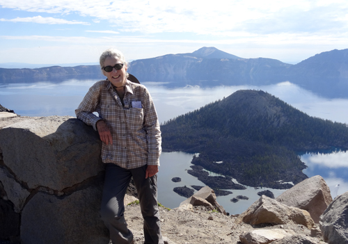
begin the hike, I drove to Crater Lake, left my re-supply box at
the store in the Mazama Campground, and then left a gallon of water
along the trail just north of Hwy 138.
I spent the night of September 1st at Cheryl and
Tom's. The next morning, Cheryl took me to the bus station in Eugene
for a bus to Medford. Bill and his wife "Pinball" met
me at the bus station and dropped me at the trail-head as planned.
Each of my Trail Angels got a bottle of wine in thanks for their
assistance. I was on the trail at 2:45 pm, and intended to do only
5 miles the first day.
 On
my other section hikes I relied on other hikers being on the trail
as a safety factor. By the beginning of September thru hikers should
be in southern Washington, as I had experienced last fall. I really
wasn't expecting to encounter many other PCT hikers, perhaps a few
other section hikers or local weekenders. But this year it seemed
that there was a group of thru hikers still on the trail in Oregon.
My first week on the trail I met 2 thru hikers, 2 people sectioning
all of Oregon, 2 local couples out for a week, 2 older men hiking
Ashland to Crater Lake, a young couple who had hiked from the southern
Sierras and were exiting at Crater Lake, and day hikers on the weekends.
In addition, there were several PCT hikers doing the trail north
to south, most planning on exiting in the Sierras. On
my other section hikes I relied on other hikers being on the trail
as a safety factor. By the beginning of September thru hikers should
be in southern Washington, as I had experienced last fall. I really
wasn't expecting to encounter many other PCT hikers, perhaps a few
other section hikers or local weekenders. But this year it seemed
that there was a group of thru hikers still on the trail in Oregon.
My first week on the trail I met 2 thru hikers, 2 people sectioning
all of Oregon, 2 local couples out for a week, 2 older men hiking
Ashland to Crater Lake, a young couple who had hiked from the southern
Sierras and were exiting at Crater Lake, and day hikers on the weekends.
In addition, there were several PCT hikers doing the trail north
to south, most planning on exiting in the Sierras.
 On
day 5 I met Jenna, a 23 yr. old graduate student at Oregon State
who was hiking the Oregon PCT. She came into my camp with a young
couple I had met the day before. I really didn't expect to see her
again, since she was planning to hike 18 - 20 miles a day, so I
was surprised when she hiked into the same camp spot the next evening.
A friend who was to join her for part of the trail was delayed,
so she had a day or two to slow down. We ended up camping together
the next couple of nights as we hiked into Mazama Campground at
Crater Lake. I try to leave camp by 7:00 am and Jenna wouldn't leave
until 9:00 am or 10:00 am, the end result being we ended up at the
designated camping spot about the same time. I might hike alone,
but it is nice to have company at night. On
day 5 I met Jenna, a 23 yr. old graduate student at Oregon State
who was hiking the Oregon PCT. She came into my camp with a young
couple I had met the day before. I really didn't expect to see her
again, since she was planning to hike 18 - 20 miles a day, so I
was surprised when she hiked into the same camp spot the next evening.
A friend who was to join her for part of the trail was delayed,
so she had a day or two to slow down. We ended up camping together
the next couple of nights as we hiked into Mazama Campground at
Crater Lake. I try to leave camp by 7:00 am and Jenna wouldn't leave
until 9:00 am or 10:00 am, the end result being we ended up at the
designated camping spot about the same time. I might hike alone,
but it is nice to have company at night. 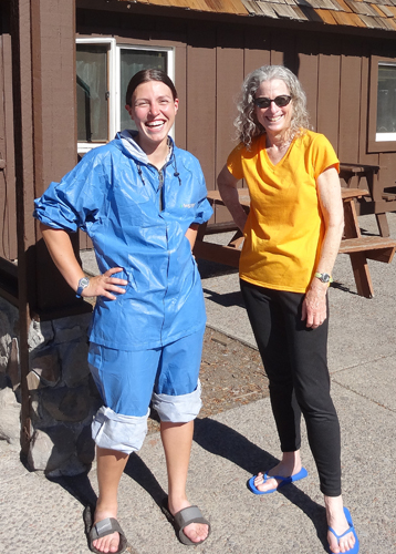
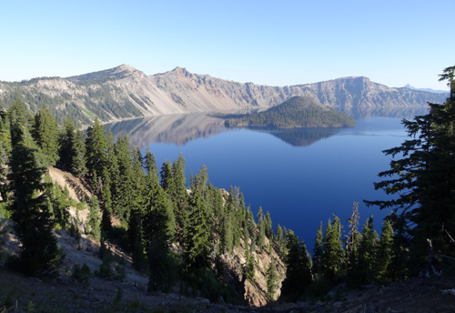
Our plan was to share the camping cost at Mazama,
but when I got a 50% senior discount with my Senior Pass, I offered
to pay the whole cost. We got showers, did laundry, and had a big
dinner at the restaurant. I was still concerned with the long dry
section and decided the next day to leave another water cache. I
offered to also leave water for Jenna. who was leaving early the
next morning, I wasn't planning to leave until late in the afternoon
and hike just two miles to an on-trail campsite. A fellow camper
offered to give me a ride and I was able to leave a gallon each
of water for Jenna and myself at a designated spot I knew on the
trail in time for Jenna to get later that day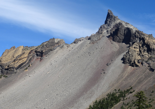 . .
The next day I arrived
at the first water cache and there was a note from Jenna thanking
me for the water after a long, hot spell. The second water cache
was waiting for me the following day nine more miles down the trail.
I only needed 2 quarts so I left the rest on the trail for hikers
behind me. This second cache allowed me the flexibility to not hike
the remaining 18 miles to the next water source. Instead I camped
on a ridge at the junction of the PCT and trail to Mt. Thielsen,
where I could watch the sunset off to the west, and the sunrise
to the east the next morning.
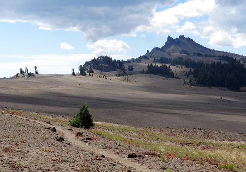
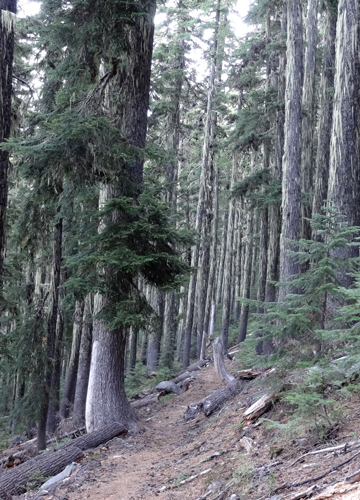 The
majority of the trail was in dense forest affording only occassional
opportunities for views, though it had been hot and the shade in
the trees was welcomed. The elevations ranged from 5,000 to 7,000
feet with climbs and descents averaging 1,000 to 1,500 ft. Day 4
was spent mostly hiking between sections of forest and lava flows.
A lot of trail work had been done to make the lava sections passable
with layers of dirt and cinder rock packed between the lava rocks
to create a trail. One takes for granted the condition of the trail
and forgets the amount of work done by the Forest Service, PCT work
parties, and other volunteer groups to make the hiking experience
more pleasant. The
majority of the trail was in dense forest affording only occassional
opportunities for views, though it had been hot and the shade in
the trees was welcomed. The elevations ranged from 5,000 to 7,000
feet with climbs and descents averaging 1,000 to 1,500 ft. Day 4
was spent mostly hiking between sections of forest and lava flows.
A lot of trail work had been done to make the lava sections passable
with layers of dirt and cinder rock packed between the lava rocks
to create a trail. One takes for granted the condition of the trail
and forgets the amount of work done by the Forest Service, PCT work
parties, and other volunteer groups to make the hiking experience
more pleasant.
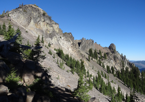
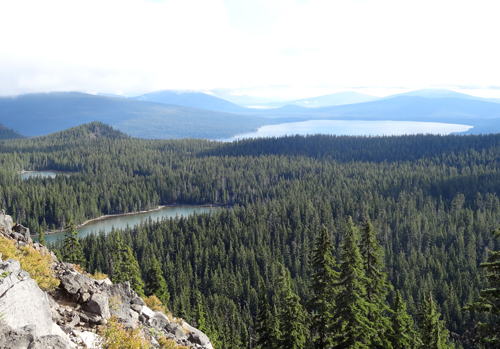 One
aspect of this section of the PCT I had not been aware of were the
numerous areas of lakes scattered over vast areas in every shape
and size. On day 5 and 6 I passed through the Sky Lakes Wildernesses
and then my last two days through the Diamond Peak Wilderness, each
with lakes too many to count. Looking ahead at the section north
of Willamette there again is a large area of many lakes that the
trail passes through. One
aspect of this section of the PCT I had not been aware of were the
numerous areas of lakes scattered over vast areas in every shape
and size. On day 5 and 6 I passed through the Sky Lakes Wildernesses
and then my last two days through the Diamond Peak Wilderness, each
with lakes too many to count. Looking ahead at the section north
of Willamette there again is a large area of many lakes that the
trail passes through.
The experiences I have with the completion of
each section builds my confidence and makes me more aware of my
surroundings. The maps I use are good at indicating water sources
and normally possible camp spots. On this section there were few
noted camp spots and I found myself studying the topography of the
maps, trying to determine where there might be a good place to camp.
Not carrying a GPS, I have to rely on geographic features to determine
my position along the trail. In most cases I was either right-on
or within half a mile where I estimated my position. It was heartening
to see Jenna also using her maps in the same way, and not relying
on her smart phone and GPS. In my opinion, this affords me greater
opportunity to become better acquainted with my surroundings, rather
than to devote my attention to an electronic device.
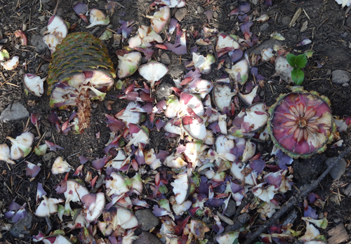 The
squirrels and chipmunks were very busy getting ready for winter.
There would be piles of shredded young pine cones on the trail.
And in many sections of the forest there were lots of mushrooms,
all shapes, sizes and colors. A common one averaged about 8 - 10
inches in diameter, looked like brains, and is apparently well liked
by the elk as some had large bites taken out of them. The
squirrels and chipmunks were very busy getting ready for winter.
There would be piles of shredded young pine cones on the trail.
And in many sections of the forest there were lots of mushrooms,
all shapes, sizes and colors. A common one averaged about 8 - 10
inches in diameter, looked like brains, and is apparently well liked
by the elk as some had large bites taken out of them.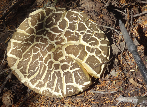
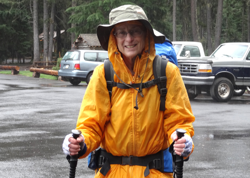
The weather is always a concern on the trail,
and I had expected some rain as the forecast the day I left was
for rain in the Ashland area. Once again I lucked out. The first
couple of nights and days there was a feeling of rain in the air,
but I only witnessed a few drops. A couple I met on day 5 told me
that they had heavy rain two nights before and they were perhaps
30 miles away. Most nights I "cowboy camped", only putting
up my shelter when the skies looked threatening.
I got a weather forecast update on day 7, Sunday,
that a storm would be coming through on Tuesday, my last day. I
took a chance Monday night, "cowboy camping", and laid
awake until about 2:00 am to lightening flashing up the sky in the
distance. It was coming. As I hit the trail my last morning low
clouds hid Diamond Peak and my clothes became damp from the moisture
in the air. About 12:30 pm, 4 miles from my final destination, thunder
roared overhead and the rain began, turning the trail into a creek.
I put on my rain gear but didn't protect my pack. I was glad that
I only had a short distance to go and I'd be done!
 I
called Cheryl to let her know I was finished and to find out when
it would be convenient to pick me up as I had completed the section
sooner than I had expected. She was doing me a favor and I didn't
want her to feel pressured to come that day. I was prepared to spend
the night if necessary, but was really hoping she could come then
since my gear was wet. The prospect of spending the night in the
rain was not appealing after all of the miles completed. She called
back and said she'd be there in a couple of hours. The perfect end
to the hike! I
called Cheryl to let her know I was finished and to find out when
it would be convenient to pick me up as I had completed the section
sooner than I had expected. She was doing me a favor and I didn't
want her to feel pressured to come that day. I was prepared to spend
the night if necessary, but was really hoping she could come then
since my gear was wet. The prospect of spending the night in the
rain was not appealing after all of the miles completed. She called
back and said she'd be there in a couple of hours. The perfect end
to the hike!
 And
my knees? No problems! Only the normal aching at night. I took acetaminophen
in the morning and at night, used my poles correctly, and took my
time. I did not develop any blisters. But anything might happen
on the next section. For now, I'm good to continue, as there is
always another hill to climb, a stream to cross, a star to sleep
under. And
my knees? No problems! Only the normal aching at night. I took acetaminophen
in the morning and at night, used my poles correctly, and took my
time. I did not develop any blisters. But anything might happen
on the next section. For now, I'm good to continue, as there is
always another hill to climb, a stream to cross, a star to sleep
under.
A special Thank You to my Trail Angels,
Cheryl and Tom, and Bill and Pinball.
The next section of the trail to hike is
still being thought out - maybe the Sierras.
|
