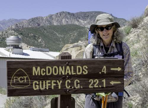
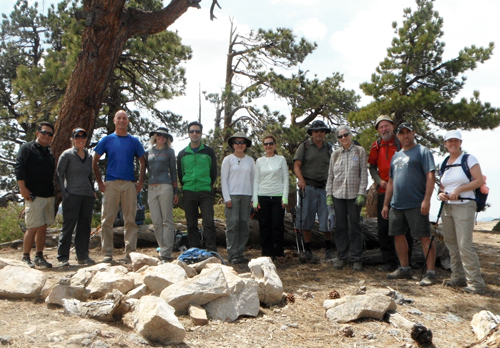
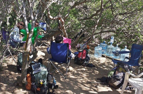
|
I'm calling this portion of the trail the "Just
Get 'er Done" section. There are three major detours off the
trail; one to avoid the Mountain Yellow-Legged Frog, an endangered
species, and two due to fire, the Station Fire of 2009 and the Powerhouse
Fire of 2013.
 On
April 14th my brother John once again took me to the trail head
in Cajon Pass, this time for me to hike north for 175.6 miles. In
keeping with my usual first-day strategy, camp would be after six
miles, allowing my body to break-in slowly and because there wouldn't
be any good campsites for about 15 miles farther. The water cache
I was expecting at mile 6 was empty, but I had filled an extra quart
before starting, and was carrying 3 quarts. The night was clear
with a full moon, a good start. On
April 14th my brother John once again took me to the trail head
in Cajon Pass, this time for me to hike north for 175.6 miles. In
keeping with my usual first-day strategy, camp would be after six
miles, allowing my body to break-in slowly and because there wouldn't
be any good campsites for about 15 miles farther. The water cache
I was expecting at mile 6 was empty, but I had filled an extra quart
before starting, and was carrying 3 quarts. The night was clear
with a full moon, a good start.
The next morning, a half mile up the trail, two pints of water had
been cached by others for following hikers. I took one, knowing
that the next 12 miles would be hot and dry, and the trail would
ascend 4,000 ft. Luckily I ran into two guys in a pickup truck later
in the day who gave me another 750 milliliters of water, by then
very much appreciated. Night two's camp was just before the summit,
in among the pines, another lovely night.
I had started out with only two days of supplies, making the long
ascent easier and knowing that after 20 miles I would be in Wrightwood
where I had a major re-supply waiting at the post office. The morning
of day three was an easy 3 mile hike to the Acorn Trail and a steep
1500 foot descent into Wrightwood. I picked up my box of provisions,
spent an hour in the shade getting organized, and then called a
local Trail Angel (residents volunteering to assist hikers) to see
if I could get a ride to the bottom of the trail, about 2 miles
from town. He picked me up, had to run a few errands, and then invited
me back to his place to rest as I didn't want to do the hike back
up the trail until later in the cool of the afternoon. I wasn't
looking forward to the steep climb back up the trail, fully loaded
after the re-supply. During our rambling conversation I asked if
the gate to the road that would actually take me close to the top
of the Acorn Trail was open. He was game to find out, and as luck
would have it, it was. He drove me all the way to my campsite for
the night. I had company that night from Luke, a young thru-hiker
from Puyallup, WA.
 So
far things were going along nicely. The next morning the trail followed
the north side of the ridge, and there
were about 4 sections of snow drifts over the trail from a storm
two weeks before. I had carefully navigated my way across several
of the drifts, and was navigating the second to last when I slipped,
didn't slide off the trail, but was on my butt in a very small clear
patch wondering how I was going to get up. Then my poles slid down
the bank. Getting up without them was nearly impossible. I took
off the pack, but still knew that once I got up it would be difficult
to get the fully loaded pack back on in the small dry patch on which
I was stranded.The next 10 feet were icy as well. So I decided to
let the pack slide down the bank, which proved to be the wrong decision.
Once the pack hit the rocky slope the weight of the pack propelled
it ever faster, and it went tumbling further down, finally being
stopped by a tree. Anything that wasn't secured inside the pack
had been tossed every which way. Having lost my confidence, with
no poles, I then decided that I would slide down, somehow managing
to not do any damage to myself or my pants. So
far things were going along nicely. The next morning the trail followed
the north side of the ridge, and there
were about 4 sections of snow drifts over the trail from a storm
two weeks before. I had carefully navigated my way across several
of the drifts, and was navigating the second to last when I slipped,
didn't slide off the trail, but was on my butt in a very small clear
patch wondering how I was going to get up. Then my poles slid down
the bank. Getting up without them was nearly impossible. I took
off the pack, but still knew that once I got up it would be difficult
to get the fully loaded pack back on in the small dry patch on which
I was stranded.The next 10 feet were icy as well. So I decided to
let the pack slide down the bank, which proved to be the wrong decision.
Once the pack hit the rocky slope the weight of the pack propelled
it ever faster, and it went tumbling further down, finally being
stopped by a tree. Anything that wasn't secured inside the pack
had been tossed every which way. Having lost my confidence, with
no poles, I then decided that I would slide down, somehow managing
to not do any damage to myself or my pants.
It took me forty-five minutes to gather everything up. The poles
were the hardest to reach as they were on the icy snow bank and
there wasn't much for me to grab onto. But somehow I recovered them.
No damage was done to the pack or water bottles but I did lose my
camera. The zipper of the waistband compartment wasn't closed all
the way and the camera must have propelled itself off down the slope.
I spent quite a bit of time looking for it but with no luck. All
this was taking place on a steep and very slippery scree slope.
Finally, back on the trail, I had one more snow bank to cross, but
having lost my confidence - as well as my camera - I took a big
detour up and over the icy parts.
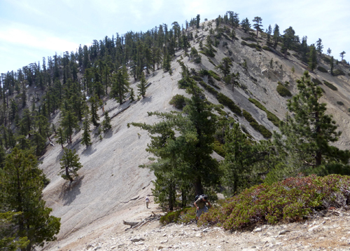
Mid-afternoon brought the first decision as to which of the three
detours around the yellow-legged frog area I would take. After my
morning disaster I decided not the go up Mt. Baden-Powell which
had numerous icy snow banks to cross, but to take the lower High
Desert Trail. About 2 miles down the trail I had to cross a large,
dry creek bed and continued on what looked like the obvious continuation
up a very steep, loose slope. After dragging myself up the bank,
it became evident that it wasn't the correct way and I had to slide
back down. All this scrambling up steep slopes was taking a toll
on my old body. I re-crossed the creek bed, noticed the possibility
of a trail down the creek bed, and, after a little exploring, finally
found the trail. Five miles later I was at my campsite for the night.
 The
next morning brought a new day, and I was off once again with my
confidence restored. The trail followed an active creek bed and
then began a steep 1500 foot ascent. As I proceeded up the stream
bed I didn't listen to my instincts which told me that I had passed
the intersection with the trail up out of the streamed. Instead
I continued up the creek bed, climbing over rocks, crossing the
stream many, many times and not finding the junction trail. I probably
went a two miles upstream before I finally gave up and went back
down. Of course I had no problem finding the trail head on my return,
but I had just wasted 4 hours. If I had read the map correctly I
would have noticed that the trail head was only 1 mile out of camp.
I took a long break and began the hike out of the stream about 2:00
pm. The
next morning brought a new day, and I was off once again with my
confidence restored. The trail followed an active creek bed and
then began a steep 1500 foot ascent. As I proceeded up the stream
bed I didn't listen to my instincts which told me that I had passed
the intersection with the trail up out of the streamed. Instead
I continued up the creek bed, climbing over rocks, crossing the
stream many, many times and not finding the junction trail. I probably
went a two miles upstream before I finally gave up and went back
down. Of course I had no problem finding the trail head on my return,
but I had just wasted 4 hours. If I had read the map correctly I
would have noticed that the trail head was only 1 mile out of camp.
I took a long break and began the hike out of the stream about 2:00
pm.
This trail is described as "not up to normal PCT standards...,
and a trail that sometimes crosses steep eroding hillsides with
difficult footing". I soon found out what that meant. The trail
was narrow, on the edge of the rock face with no room for any error.
I've been on trails where portions of the trail have been eroded
and you have to carefully navigate across the sections of trail
that no longer exist. As I continued up the trail these sections
became larger and more difficult to get across. One wrong move and
the fall would be steep and deadly. I actually came to one section
and stood there thinking that there was no way I could continue.
But the thought of turning around wasn't appealing either. Somehow
I managed to get through, but not without many moments of terror.
At one point I had to step onto the broken away section and began
slowly sliding down. To my rescue was a small bush that I could
grab onto and get myself back up onto the trail. Not something I'd
like to experience again anytime soon.
Just before the top of the trail was a spring and a small section
of the trail widened out enough for me to put down my sleeping bag,
my first time sleeping right on the trail. But not before the lightning
and thunder-showers rolled past, sprinkling on me lightly before
the storm moved on. Those hikers on the Baden-Powell section got
snowed on.
 The
next day the trail followed 4.1 miles of the PCT, then a 2.7 mile
road walk, a 1.5 mile section of the Burkhart trail that finally
hooked back into the PCT and the completion of the "frog detour".
I had one more mile to climb up to the road where I met 4 male PCT
hikers camped along the road at the trail head After a brief conversation
I took off, expecting them to pass me at some point. The trail continued
to climb and before reaching the summit of Mt. Williamson it would
branch off to the left. I was on the alert for the junction. Suddenly
the trail became very rough and steep, and I was soon at the summit,
then walking along a knife edge ridge, before dropping down a very
steep trail with switch-backs every five feet. I saw lots of footprints
but my internal radar was definitely feeling something wasn't right.
At the bottom of the steep cliff, it was a scramble up the other
side, along another ridge, and finally a drop again onto a another
saddle where the trail seemed to disappear. The
next day the trail followed 4.1 miles of the PCT, then a 2.7 mile
road walk, a 1.5 mile section of the Burkhart trail that finally
hooked back into the PCT and the completion of the "frog detour".
I had one more mile to climb up to the road where I met 4 male PCT
hikers camped along the road at the trail head After a brief conversation
I took off, expecting them to pass me at some point. The trail continued
to climb and before reaching the summit of Mt. Williamson it would
branch off to the left. I was on the alert for the junction. Suddenly
the trail became very rough and steep, and I was soon at the summit,
then walking along a knife edge ridge, before dropping down a very
steep trail with switch-backs every five feet. I saw lots of footprints
but my internal radar was definitely feeling something wasn't right.
At the bottom of the steep cliff, it was a scramble up the other
side, along another ridge, and finally a drop again onto a another
saddle where the trail seemed to disappear.
 Where
were those 4 other PCT hikers I kept expecting to come along? I
returned to the last point of obvious marked trail, sat down, and
almost immediately heard voices. As they got closer I could hear
female voices, until finally a group of about 14 day hikers came
down the slope to where I was. I asked the first hiker which way
was the PCT and he gave me a blank look and said ask the leader.
When the leader, Paul, showed up and I asked about the PCT, he laughed
and said it was about 2 miles back. I wasn't the first PCT hiker
he met that missed the turn-off but I had come the furthest! He
said the sign was gone and the turn off not well marked. No way
was I going back the way I had just come. "Is there any other
way?" I asked, to which he replied, "yes, follow us." Where
were those 4 other PCT hikers I kept expecting to come along? I
returned to the last point of obvious marked trail, sat down, and
almost immediately heard voices. As they got closer I could hear
female voices, until finally a group of about 14 day hikers came
down the slope to where I was. I asked the first hiker which way
was the PCT and he gave me a blank look and said ask the leader.
When the leader, Paul, showed up and I asked about the PCT, he laughed
and said it was about 2 miles back. I wasn't the first PCT hiker
he met that missed the turn-off but I had come the furthest! He
said the sign was gone and the turn off not well marked. No way
was I going back the way I had just come. "Is there any other
way?" I asked, to which he replied, "yes, follow us."
 So
I spent the next 2 hours hiking with the group until we reached
the Burkhart trail, the trail I would have taken to reconnect with
the PCT, but now coming from the opposite direction. It was a fun
group and they were all impressed that I could keep up with them
on the ascents, though slow on the descents. They were all taking
lots of pictures, which they agreed to share with me as I had lost
my camera. A potential disaster turned positive. Actually we met
a lone male day hiker who was going in the opposite direction that
I would have met if I hadn't run into the group. Fortunately for
me, it was a Saturday and there were lots of day-hikers out. One
of the hikers in the group I joined asked "What would you have
done if we hadn't come along?" Luckily they came along before
I even had to think about that decision! So
I spent the next 2 hours hiking with the group until we reached
the Burkhart trail, the trail I would have taken to reconnect with
the PCT, but now coming from the opposite direction. It was a fun
group and they were all impressed that I could keep up with them
on the ascents, though slow on the descents. They were all taking
lots of pictures, which they agreed to share with me as I had lost
my camera. A potential disaster turned positive. Actually we met
a lone male day hiker who was going in the opposite direction that
I would have met if I hadn't run into the group. Fortunately for
me, it was a Saturday and there were lots of day-hikers out. One
of the hikers in the group I joined asked "What would you have
done if we hadn't come along?" Luckily they came along before
I even had to think about that decision!
Back on the official PCT, the next couple of days were as normal
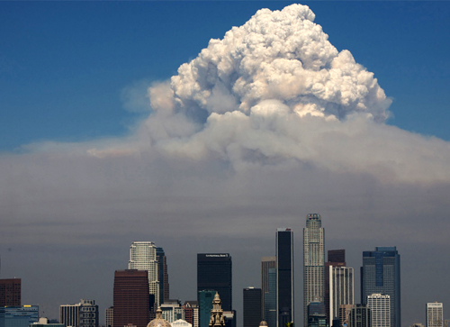
as long distance hiking can get. The Station Fire made 20 miles
of trail almost impossible to hike. There was lots of down-fall
and a plant called Poodle Dog Bush, which blooms rapidly after fires
in this area and is toxic, totally covered the trail. I opted for
the road, as did most hikers, which paralleled the trail for most
of the 20 miles.
 Once
past the Station Fire the trail began to descend and I noticed that
horses had been through recently and had roughen up the trail, leaving
many deep pot-holes. Many sections of trail were completely covered
by brush, making it difficult to avoid the deep holes made by the
horses. I soon learned that a young woman with two horses was attempting
to be the first horse person to thru-ride the PCT. I would finally
catch up with her 2 days later and was surprised that the horses
were a lot more hyperactive than I would have expected for trail
animals. Once
past the Station Fire the trail began to descend and I noticed that
horses had been through recently and had roughen up the trail, leaving
many deep pot-holes. Many sections of trail were completely covered
by brush, making it difficult to avoid the deep holes made by the
horses. I soon learned that a young woman with two horses was attempting
to be the first horse person to thru-ride the PCT. I would finally
catch up with her 2 days later and was surprised that the horses
were a lot more hyperactive than I would have expected for trail
animals.
Night 9 was spent at a KOA campground just off the trail in Acton,
and provided an opportunity to get a shower and wash my clothes.
I had been pushing it hard the last 3 days, doing 16 and 17 miles
per day, so it was nice to get a shower and camp on a nice flat
lawn. Actress Tippey Hedren, who starred in Alfred Hitchcock's "The
Birds", has a refuge for big cats just down the road, and the
cats could be heard roaring just before feeding at night and in
the morning.
The wildflowers were out in full force and tour buses and individual
cars were out to view them. As I left the KOA the next morning,
about a 2 mile section of the trail was completely lined by wildflowers
of every color and size. Where's my camera! It was a treat to be
hiking again on a nice trail, on a nice day, with no one in site,
enjoying the beauty around me.
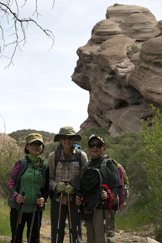
A few hours later I was approaching the Vasquez Rocks outside Agua
Dolce. The trail passes through a pedestrian tunnel under the highway
and as I approached I ran into a group of Koreans from Los Angeles
on a day trip to view the wildflowers. I told them they should go
to Acton and walk the trail a few miles. After a brief conversation
I continued on into the Vasquez Rocks wishing I had a picture of
myself among the rocks. But wait! There are about 15 people behind
me, probably all with cameras. I'm sure I can get one to take my
picture and email it to me. So I waited, and when the Koreans arrived,
I got one to take my picture.
 Aqua
Dolce is the home of the Saufley's, who serve as Trail Angels. I
arrived about 1:00 pm and spent the rest of the day relaxing, talking
with other hikers and picking up my next re-supply box. The four
hikers I had met briefly 3 days before were there, and it turned
out that instead of hiking the section of the PCT on which I had
gotten lost, they decided to hike the road and save themselves about
8 miles of trail. More later on my feelings about skipping parts
of the trail. Aqua
Dolce is the home of the Saufley's, who serve as Trail Angels. I
arrived about 1:00 pm and spent the rest of the day relaxing, talking
with other hikers and picking up my next re-supply box. The four
hikers I had met briefly 3 days before were there, and it turned
out that instead of hiking the section of the PCT on which I had
gotten lost, they decided to hike the road and save themselves about
8 miles of trail. More later on my feelings about skipping parts
of the trail.
By evening there were about 20 people and a large fire was going.
Unfortunately, I was "cowboy camping" (sans tent) about
20 feet from the fire, and was kept awake by conversations I've
heard many times before. I was looking forward to getting back on
the trail by myself the next morning.
Due the fact that the last 30 miles of trail I would be hiking had
been shortened to 20 miles because of the detour of the Powerhouse
Fire of 2013, I had gained an extra day. I decided to slow down.
I met a 66 year old woman named River from Orcas Island, WA hiking
a 400 + mile section north to south. We talked for quite a while
on the trail and I liked her attitude - just take it as it comes.
Sometimes that's hard. As senior hikers putting in only 10 to 15
miles a day we have to carry more food and water, hence a heavier
load, than the younger hikers. By our way of thinking, that makes
us tougher! She also said that on the next fire detour she had walked
the aqueduct instead of the road. One of the advantages was that
the 20+ mile detour could be broken up and one could camp easily
along the aqueduct.
Some Trail Angels take the term a little further than others. At
mile 471 is Oasis Cache, probably one of the most unusual water
caches on the trail. The Andersons, Trail Angels nearby, have created
literally an oasis among the small oaks along the trail with, in
addition to water, chairs, blow up palm trees and a plastic Frankenstein!
Where is my camera!
 April
25th I arrived about 1 pm at the ranger station that delineated
the beginning of the road detour. A storm was approaching, the sky
was clouding over, and the wind was beginning to blow hard. I spent
time talking with the Rangers, making sure I had the right instructions
for getting to the aqueduct, a walk requiring 4 miles of road walking.
Camp would be made behind the ranger station, but there really wasn't
any spot protected from the wind except directly behind one of the
station buildings, exactly what the rangers didn't want. I decided
that I would wait until the rangers left, and then I would hunker
down behind a shed, out of the wind. Two older Canadian thru hikers
arrived and decided to also camp at the station. I tried to set
up my "tent" but it was too windy, so I would "cowboy
camp" and hope it didn't rain. April
25th I arrived about 1 pm at the ranger station that delineated
the beginning of the road detour. A storm was approaching, the sky
was clouding over, and the wind was beginning to blow hard. I spent
time talking with the Rangers, making sure I had the right instructions
for getting to the aqueduct, a walk requiring 4 miles of road walking.
Camp would be made behind the ranger station, but there really wasn't
any spot protected from the wind except directly behind one of the
station buildings, exactly what the rangers didn't want. I decided
that I would wait until the rangers left, and then I would hunker
down behind a shed, out of the wind. Two older Canadian thru hikers
arrived and decided to also camp at the station. I tried to set
up my "tent" but it was too windy, so I would "cowboy
camp" and hope it didn't rain.
About 11:30 pm it began to rain and I began to get wet. The only
place out of the rain was the covered porch of the bunk house, so
I picked everything up and after chasing down belongings that kept
blowing away, settled in, out of the rain.
When I got up the next morning the Canadians were up and on the
road trying to hitch a ride to the junction a few miles down the
road. As a section hiker, I feel that I need to hike every mile
of trail, or designated detour. Many of the through hikers were
avoiding parts of the trail, hiking roads, always in a hurry. It
seems that some hikers are missing the purpose of hiking the complete
PCT. Their concern is more about how fast they go, getting to the
end, and avoiding an early winter storm as they approach the Canadian
border. Well, the storm that was coming in was dropping new snow
in the Tehachapi and Sierra mountains, possibly delaying them down
the trail. But I believe that it's more about the journey than simply
the destination, and my personal hiking ethic demands that I actually
complete the walk.
I walked down Munz Ranch Road looking for the aqueduct. A few hours
later I came to the end of the road and no aqueduct was in site.
It was very windy and from the storm clouds passing over it was
obvious that it was raining somewhere, but luckily not on me. I
finally ran into an older man putting signs out for his antique
store, trying to capture some of the wildflower traffic (it was
a Saturday). When I asked him where the aqueduct was he replied
"Oh, you've walked about 4 miles past it. But I'll give you
a ride back since I'm headed that way." When he dropped me
off, it was clearly marked, though the signs were small, and the
reason I missed it was that it went under the road, and wasn't visible.
But I was finally on the aqueduct and had 16 miles to my final destination.
The Tehachapi Mountains were covered in new snow. The aqueduct traveled
along the foothills of the Antelope Valley and just east of the
San Andrea Fault. Except for having to walk directly into the fierce
wind it was a pleasant hike. Early in the afternoon I started looking
for a place to set up camp out of the wind, or at least in less
wind. I set up my shelter making sure I had rocks on all the stakes.
And the wind settled down about 7:00 pm, just like the forecast
said that it would. But about 11:00 pm the wind had picked up again,
and gradually the stakes were one by one being pulled out. After
about an hour of resetting stakes, I finally decided to let my poles
down, lower the resistance to the wind, and just sleep under my
fly sheet. That worked, and I finally got some much needed sleep.
 In
the morning, as I headed out, the wind was so strong and in my face
that there were moments when I had a hard time moving forward. Twelve
more miles to go, but into the wind, it could take much longer than
normal. Fortunately there were sections in the lee of the making
progress easier. By 1:00 pm I arrived at Hikertown, my final destination
and the end of the trail for me on this trip. In
the morning, as I headed out, the wind was so strong and in my face
that there were moments when I had a hard time moving forward. Twelve
more miles to go, but into the wind, it could take much longer than
normal. Fortunately there were sections in the lee of the making
progress easier. By 1:00 pm I arrived at Hikertown, my final destination
and the end of the trail for me on this trip.
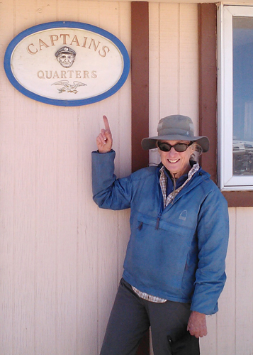
Hikertown is hard to describe. It's built around the owner's desert
home and all the surrounding rooms are small structures made to
look like a western town - Jail, Post Office, Hotel, Court House,
Barber Shop - all for PCT hikers. It was originally started by a
Harley Davidson biker, then continued by the current owner. I stayed
in the Captain's Quarters, which I thought had the best bed. It
was Sunday and I didn't need to be picked up until Tuesday so I
spent the extra day hanging out talking with the hikers as they
came through.
The Canadians I had met, that hitch-hiked out of camp, had arrived
the day before and gotten wet (remember those storm clouds that
rolled over me) as they walked and hitch-hiked the road. Apparently
the road was hard on the feet, and after hearing a few stories I
was glad that I had opted for the aqueduct. I also read the guest
book and found entries from hikers I have met the last couple of
years, including some cruising friends we met in the Cape Horn region
whose trail-names I discovered were Sailor and Pasta Alfredo.
I called my niece Jessica, who lived about 30 miles away and had
agreed to pick me up, to come Tuesday after work. She took me to
her house in Santa Clarita and I took us out to dinner as a Thank
You for her help. Jessica, you're now an official Trail Angel. Wednesday
morning she took me to the Metro Link train station where I got
the train to the Burbank Airport. The ticket kiosk wasn't working
at the station and the personnel said the conductor had been informed
and we would all ride for free. I told those around me it was because
it was my birthday - officially 65 years old!!
So the knees survived another hike and I'm now preparing for my
next section, Kennedy Meadows to Tuolumne Meadows, a 240 mile hike
through the Sierras, this August. I've finally broken down and bought
a tent, the Six Moon Designs Skyscape Trekker, a 18 ounce solo tent!
A hiker I met had the same tent and couldn't say enough about it.
|
