 |
||||||
|
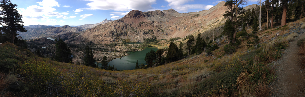
Tuolumne Meadows to Donner Pass,
CA
Mile 942.5 to 1153.4 |
||||||
|
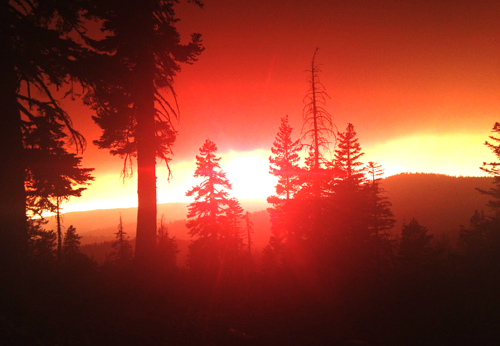
The fire that was causing the most havoc for hikers was the Sequoia Fire. Hikers on the PCT/John Muir Trail (JMT), south of where I'd begin, were having to exit the trail at Red Meadows, outside Mammoth, due not to the fire itself, but to the heavy smoke and ash it created. Some hikers choose to re-enter at Carson Pass or Echo Lake, 100 to 150 miles north of Tuolumne Meadows. It was sad to see hikers from foreign countries, who had planned to hike the JMT for at least a year, having to get off only 34 miles into their hike. But those that re-entered to the north weren't disappointed.
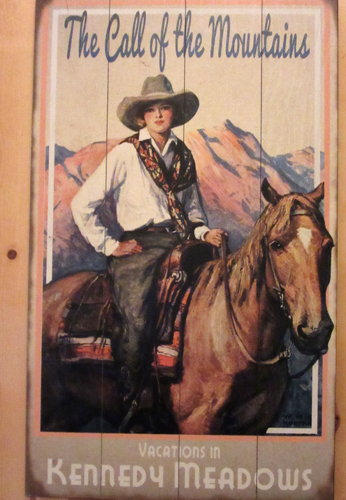
I had planned initially on having two re-supply points. Unfortunately the 2nd point was to be at Echo Lake, close to South Lake Tahoe, and it was closing on Labor Day. I would arrive about that time, but it meant that I couldn't afford any delays and the possibility missing my re-supply. So instead I changed my plan to only one pickup a week into the hike at North Kennedy Meadows, 9 miles east of Sonora Pass.
They will also send your food supply bear canister, required in Yosemite National Park, home for $20. I had planned on carrying my cannister the whole trail and did not bring any extra stuff bags for hanging my food. After spending the night asking myself whether to send it, keep it, send it, ... I opted to keep it and carry the 2.5 pounds of weight along with the 2nd re-supply food.
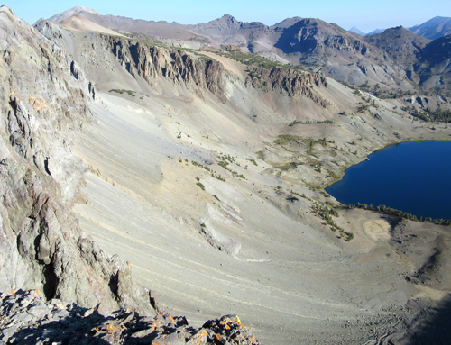
Starting with Tioga Pass, the trail crosses over five Sierra Nevada highway passes. All the passes have a gradual approach from the west, then a steep descent to the east. Depending on the winter conditions, some of the passes can close during the winter. Each pass has its own interesting history, and several were surveyed for the transcontinental railroad. Tioga Pass, 9,943 ft., on Hwy 120, is the highest road pass in California, and the one most likely to close in winter. In nine miles it drops 3,000 feet to Hwy 395. It was named by a New Yorker after the Tioga Mine, and is an Iroquois and Mohawk term meaning "where it forks".
Ebbetts Pass, 8,723 ft., on Hwy 4, was used by the Miwok and Washoe Indians to cross the mountains. The route was used only occasionally until silver was discovered east of the Sierra. Merchants in the town of Murphys had a road constructed to more easily transport supplies over the pass to the miners.
Donner Pass, 7,056 ft., Hwy 40, was first used by emigrants in 1844, but it was from the fabled Donner Party, in the winter of 1846, that it earned its name. In the spring of 1868 the route through the Sierra Nevadas was "conquered" by the Central Pacific Railroad after almost 5 years of continuous construction and the completion of Tunnel #6 at Donner Pass. There is an historical marker on the trail above Donner Pass that gives a good account of the emigrants going over near-by Roller Pass. (click on link to read more)
I ran into my first SoBo (southbound PCT thru-Hiker) just before
Sonora Pass, and would continue to meet almost 20 SoBos before departing
the trail at Donner Pass. I have run into other SoBos on my hikes
late in the summer, but this was the largest number yet. Most had
left the Canadian Border in July and were expecting to be finished
by October. I'll be curious how the Sequoia fire and those very
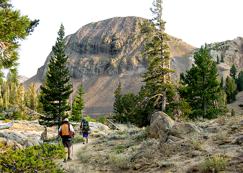
long, dry stretches south of the Sierras affected them. By 7:30 am on my last day on the trailI I had already been hiking for an hour. Suddenly I heard what sounded like a large animal galloping through the lightly treed woods. To me, the sound was that of a horse on the run, and there had been horses on the trail. As I looked up, I saw a bear running full-out in my direction, but not necessarily at me. Somehow, intuitively I knew he was not charging me, and he seemed completely unaware that I was even there. It was apparent that he would cross right in front of me, so I raised my hiking poles and let out a loud "Heh!!". He seemed to notice me for the first time, veered slightly off his course, but continued to run past me. It happened so fast and unexpectedly that I didn't have time to even be afraid, but as I continued on, I kept looking over my shoulder. I really don't think he saw me until I yelled out. After over 1,400 miles I finally had a bear story to tell. The weather overall was excellent. There were two nights of very high winds (tent held up very well) but no rain, and no lightning or thunder showers. And as is the norm on the trail, I met many fun and interesting hikers of all age groups. I have now hiked more than half of the PCT, 1,490.8 miles. I've been able to do two hikes a year, one in the spring and one late summer, but with the completion of all the Southern Californa miles, I will now, hence forward, be only hiking in late summer. And in order to complete the trail by the time I'm 70, I'll have a couple of sections of over 300 miles. Something to look forward to!
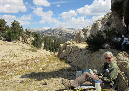
Photo by Rachel Yahn |
|
Completed Sections
|
| September
2017 Mile 1498.4 - 1328.8 |
| August
2018 Mile 2393.2 - 2591.1 |
| September
2018 Mile 1153.4 - 1331.3 |